Technology doesn't have to be something that divides us from nature. It can be a tool through which we can explore the natural world...


Tuesday, 16 July 2013

Red Deer River Journey - Part Eight


From Parkland to Prairie

“Nature is not human hearted.” - Lao-Tzu

Blooming prickly pear cactus in Dry Island Buffalo Jump Provincial Park
The next morning, I was off down the river as usual. It was a Saturday, so plenty of people were out canoeing this popular stretch of the river. From Trenville, the next major stop is the MacKenzie Crossing, which was busy with canoeists, campers and fishermen out to catch some goldeye or possibly a pike or walleye. Some of the walleye in this section of the Red Deer can get very large. The largest one I’ve encountered was twenty-nine inches long. Goldeye are more common. They arrive from downstream in late May and can be voracious through June and into July. They were a favorite meal for the members of the Palliser Expedition.

“Burnham, intent on the search for gold, wanted to see if there was any to be found in the Red Deer River. Palliser told him that he feared the geology of the country would not admit of there being any, but went along with him and Paul. They washed and panned for a considerable time, they found no gold, but they did get a couple of gold-eyes as well as a beaver for dinner.” 1

As I continued heading southward, the valley began to deepen and to look more like the badlands that most Albertans are familiar with. I was approaching a place with which I was very familiar.
 
I parked my canoe at the boat launch of one of my favorite parks. Dry Island Buffalo Jump Provincial Park is both biologically and geologically diverse and is situated on the transition zone between parkland and prairie regions. The valley at this point is two hundred metres deep and contains several distinct levels.


Western wood lily in badland coulee within the park
The north side of the park is fairly typical of a badlands environment, but with some surprises. There is the riparian zone at the lowest level, containing tall grass and willow. On the edge of the riparian zone are some cottonwoods. The next level is a mixture of grassland, bentonite clay and stands of balsam poplar and aspen. Greasewood and cactus dot the harshest parts of the landscape. In June/July there are a multitude of flowers in bloom - including the cactus. More sheltered spots have the beautiful wood lily on display. The typical badlands clays, layered in lighter and darker bands, rise up from this level to that of the surrounding prairie. Also on the north side of the park is the “Dry Island” - a plateau that rises above the surrounding badlands. At its flat summit is a sample of the natural fescues that dominated the surrounding prairie before cultivation. The isolation of the Dry Island serves to preserve these unspoiled natural grasses.
On the north facing slopes and in the many coulees that intersect the badlands there are stands of white spruce. On many a hot afternoon, I have found myself seeking out the cooler shelter of one of the coulees, while I take a break for lunch or simply to get out of the overpowering heat that builds up in this valley. When one looks around themselves in these coulees, they could almost believe that they were in the rocky mountain foothills. This provincial park certainly is a place of contrasts.

On the south side of the park the landscape is different again. It still contains some of the badland’s characteristics, but less so. The land rises more suddenly from the river to a “step” about a hundred metres above the valley bottom. On this level there are aspen, white spruce, willow and dogwood. There is also a stand of paper birch, which is at the southern limit of its range in this province. This is a favored spot for porcupine. There are many mule deer in this area and their trails are every where. There are also some surprises in this knob and kettle terrain. Many hidden ponds and marshes dot this section of the park. They contain boreal chorus and wood frogs. They also provide an attraction for the moose. Of course, the park’s many coyotes can be heard, especially near dusk. Their lonely cries echoing across the valley usually draw a chorus of responses from their kindred animals.
 

The western edge of this level is contained by sheer sandstone cliffs that rise up to the grade of the surrounding prairie. Prairie falcons nest on these cliffs and can be viewed as they hunt and defend their territory. One section of the escarpment was used as a buffalo jump by aboriginal peoples intermittently over a ten thousand year period. The bones of the bison can be found in the soils below the jump. The view from the top of the escarpment is superb. Many times in the spring, I have stood atop these cliffs and watched groups of bald eagles coming from the south, following along the valley on to their northern destinations. I have watched a bull moose in rut during an early winter snow storm, laboring under the heavy weight of its huge antlers. I have seen flocks of turkey vultures flying next to and falcons soaring below this vantage point. Richardson’s ground squirrels (“gophers” to most of us) and badgers live in these uplands and once I came upon a porcupine whose only way to protect itself in this exposed position was to place its head out over the cliffs while it showed me its spiny backside. One spring, in defense of its territory, a mountain bluebird attacked the side mirror of my truck. I returned to the cliff top parking lot to find my driver’s side door covered with droppings and the angry bird still crashing repeatedly into its own reflection.

I had lunch near the boat launch (sandwiches again!) and set off downstream. This time I had a lot of company on the river. Several groups of canoeists were traveling alongside me. A small group made up of two young men and their bikini clad girlfriends, floating along in a motley collection of tubes and dinghies, braved the stretch from the buffalo jump to Tolman Bridge. I’m sure that this stretch of the river was longer than they expected and it was made even more difficult to traverse due to a particularly strong headwind. The scantily clad tubers had few supplies or alternate clothing, but they did have plenty of beer. I was a bit concerned about their safety, but my worries seemed to be for nothing, because I saw them much later in the day, laughing and frolicking in the river.

At one point I got fed up and pulled my canoe up onto the bank to rest and curse the raging headwind. After a little nap, the wind died down a bit and I set off again. As I passed under the Tolman Bridge, I waved at some of the folks that I had chatted with at the buffalo jump and continued on for another hour or two into a more opened bottomed section of the valley. I found a site along the bank, near the opening to a narrow coulee and set up a makeshift camp.
 
A sudden storm during supper almost spells disaster
I was considering sleeping under the stars and not bothering with setting up the tent, but when I looked northward, toward Tolman Bridge, there were black clouds forming and moving eastward across the sky. I was famished so I quickly set up my tent, threw everything inside except my stove and cooking utensils and began cooking supper. The angry looking clouds were moving closer and I realized that my dinner preparations had become a race against time. Supper was almost ready and it looked like I would have enough time. A bit of rain wouldn’t be that much of a problem after all, on such a hot day. Suddenly a huge gust of north wind blew my tent and its contents right on top of me. It was a miracle that my stove didn’t catch the whole works on fire. In my haste to set up camp, I had neglected to peg my tent down. I instinctively grabbed the tent and threw it down. I unzipped the doorway and jumped inside, hoping my weight would hold everything down. I reached outside and shut off my trusty Coleman stove, grabbed my (now ready) pasta supper and sat on the edge of my air mattress, watching the rain and the lightning bolts. After five minutes, the storm moved on and the sun reappeared. It was once again, a still, warm summer evening as I reflected on this typical prairie weather.

I was in the prairies now. I had left the parkland region that morning, somewhere near the buffalo jump. There was not really a clear demarcation, but this was definitely prairie. The rest of my journey would be through some version of this vast region and I wasn’t even half way through my trip. I was feeling a little tired and lonely as I retired to my sleeping bag that night.

Monday, 15 July 2013

Red Deer River Journey - Part Seven


The Great Bend

“Art is man's nature: Nature is God's art.” - Philip James Bailey
 

Metis flag at Tail Creek - the oldest flag to originate in Canada
I woke up amongst a flock of pelicans, who were fishing the stretch of river near my camp. I watched a small cattle roundup across the river, while I had breakfast and took down my tent. This was a stretch of the river that I wasn’t particularly looking forward to. It wasn’t because it was a difficult stretch, but it didn’t seem like a very interesting prospect when I was planning my trip. I thought of it merely as a necessary prelude to the badlands portion of the journey. I was pleasantly surprised.

This stretch of the river heads nearly straight east and away from Red Deer before it jogs north briefly, then east again to the Content Bridge. It also travels through some fine parkland country. I tackled a small rapid below a sandstone cliff where some falcons made their home. I was later told that these were transplanted peregrines as part of a project to reintroduce them into this area. Further on, I watched a coyote stalk through some high grass near the river’s edge, hoping for a snack of killdeer chicks. The passing of my canoe ruined his morning hunt.

I approached a bend in the river and some unique cliffs with some historic significance. Palliser Expedition geologist, James Hector mentions these burning bands of coal in his journals. They are evident because of the layers of shale which have become a pink color due to the heat of the burning coal. His Cree guides told Hector that this coal had been burning for as long as they could remember. I have heard that trees in the area have been known to catch fire from the roots up.

Above the cliff containing the coal seams (their wings a telltale “V”) a couple of turkey vultures soared -- riding the thermals up into the sky. Two red tailed hawks joined them. Turkey vultures are a fairly common sight in the badlands of the Red Deer River, but they would have been here in the thousands when James Hector ventured into this region. At that time, huge flocks of these scavengers grew fat consuming the carcasses of the buffalo that existed in their millions. What a different world it was in those days. Perhaps, in the Red Deer River Valley one can just catch a glimpse of what that world might have been like.

As I drifted around the beginning of the “Great Bend”, a massive nest perched in a large cottonwood tree came into view. I pulled the canoe onto the bank and got out to investigate. Sure enough, there were a couple of unfledged bald eagles in the nest. I scanned the surrounding trees and sky and I spotted the parents of the two homely looking juveniles. They swooped down and called at me, threatening me with their outstretched talons, but I was never really in any danger. It was all for show and the eagles never got close enough to be a problem. They were nothing like the Swainson’s hawk of the previous summer, who tried to dive down onto me when I got too close to her nest. I had to fend her off with a camera tripod held above my head like a three pronged crown. Pleased at having confirmed an active bald eagle nest along the river, I got back into my canoe and paddled on to the Content Bridge and the campground, where I spent that night.
 

One of the few signs of the Metis
settlement near the Content bridge
I woke up in a noisy campground (due to its location adjacent to a gas plant). It wasn’t the most beautiful spot in the world, but the campground operator was friendly and helpful. I managed to get all my video batteries charged and get some ice for my cooler. I even had a tasty ice cream cone -- such luxury! After the usual routine of breakfast, tearing down camp and loading the canoe I was ready for another day on the river.

I continued under the Content Bridge and on my way around the “Great Bend”- a point at which the river changes its heading from eastward to a southerly direction. Almost immediately the scenery began to change. There were still plenty of white spruce, aspen and poplars along the river, but the clay that one associates with the badlands became visible along the walls and embankments of the valley. The river was flowing southward now into a transition area between the parkland and prairie regions. I came to a rapid of some note. It is, in my opinion, the last real rapid on the river. The water pours over a small dyke of harder rock, which creates a bit of a ledge. It was an easy enough ride and afterwards I turned my canoe around to look at “The Backbone”.

Depiction of Henday meeting Blackfoot chief near Pine Lake
courtesy Alberta Museum
The Backbone certainly has some possible historic significance. Two hundred and fifty years ago, Anthony Henday, along with his two Cree guides, is said to have crossed the Red Deer River at this point. It was in October 1754 and the river would have been a lot lower than on this July day. He used the Backbone to ford the river and presumably keep his feet dry. Working for the Hudson’s Bay Company, he was on a mission to establish trading with the local Indian tribes and to encourage them to bring their furs to York Factory on the Hudson’s Bay. The mission was a failure. The Nitsitapii people weren’t at all interested in making the long journey to the Hudson’s Bay. They didn’t travel by canoe and probably felt they had everything they needed, but they were gracious hosts and politely received Henday at a large encampment at nearby Pine Lake. Nevertheless, this smuggler from the Isle of Wight and net mender for the Hudson’s Bay Company became the first European to visit this land and see the Rocky Mountains. That is one version of the story anyway. Henday’s original journals have disappeared to be replaced by four somewhat contradictory and highly edited versions of his journeys. I prefer the version in which he came this way and (for me) seeing the Backbone gave life to his amazing story.


Pileated woodpeckers
I was near my home now and I pulled my canoe into the familiar Trenville Park Campground. It is a very pleasant spot and is a favorite destination during the summer months. I checked out the bird boxes along the fence line and found mountain bluebirds bringing various grubs to their progeny along with one containing a purple martin. There was a family of ruffed grouse, some cottontail rabbits, as well as sapsuckers and pileated woodpeckers in the campground. I lowered a shotgun mike into a beaver lodge to listen through my headphones, to that year’s young make plaintive noises while their parents splashed in and out. It was a warm evening and human children played, splashed and cooled themselves in the waters of the river. I retired early to my tent for a sound sleep.

At Tail Creek Cemetery. One of the only pictures I have of me shooting the video for "Red Deer River Journey"

Wednesday, 10 July 2013

Red Deer River Journey - Part Six


The City


Aerial view of Gaetz Lakes (an oxbow of the Red Deer River)


 Illustration of how an oxbow is formed (from Red Deer's Kerry Wood Nature Centre)
 
Gradually the surrounding landscape began to look more pastoral. The rumble of background noise began to get louder as I approached the next bridge. This was the Highway 2 Bridge and the gateway to the City of Red Deer. As usual, the traffic was busy. I drive across this bridge daily while I go about my busy working life. Approaching Red Deer in this way gave me a new perspective on the city and indeed my life. I felt like an outsider looking in.
 
Even after I had crossed under the bridge and into the city, the immediate surroundings didn’t look too urban. The only way you would know you were in a city was by the constant drone of the traffic in the background. There were poplar trees on one side of the river and white spruce hemmed in by high north facing banks on the other. I passed a fox with some prize in his mouth, running through the willows while being pursued by several crows. A fly fisherman was in the river catching some goldeye and no doubt hoping for a nice brown trout. I paddled under the Taylor Street Bridge and beached my canoe at a boat launch near the center of Red Deer. It was five o’clock and quitting time - another hard day at the office! I wish that all of my work days could be like this one.
 
My brief stay in Red Deer gave me a chance to get cleaned up, do my laundry and have a nice meal with friends. I also had a chance to nurse my ant bites from the previous day. They had become swollen and red. I must have been quite a sight. I looked in the mirror to see my sun reddened face with the white outline of my sunglasses around my eyes. My nose was burned and blistered. I also had dropped a few pounds which really wasn’t such a bad thing. It was a nice change to worry that I wasn’t eating enough food.
 
An old schoolmate of mine had come from Calgary to join me for a day’s paddling and we met for breakfast the next morning. He was now a school teacher and had brought along one of his colleagues to accompany us. They were in their seventeen foot “Coleman” and I was once again alone in the “Prospector” as we departed from the boat launch and quickly paddled beneath the Gaetz Avenue Bridge. We carried on past the 67th Street Bridge, beyond the Riverside Industrial Park and Three Mile Bend. This was the first stretch of the river that one looking from their canoe could really see that they were in an urban area. We canoed out of Red Deer, past the mouth of the Blindman River and into the Canyon area.
 
The Canyon
Aerial view of the Canyon (from SD video)
The Canyon was formed quite recently on the geological scale of events. Thousands of years ago the Red Deer River flowed north from this spot and followed the present course of the Battle River to link up with the North Saskatchewan River. At the end of the last great ice age (twelve thousand years ago) the retreating ice sheet blocked the northerly flow of the river and formed an expansive lake, which covered the entire Red Deer area. This large body of water stretched as far south as present day Innisfail. The river found a way eastward, carving through the “Divide Hill”, changing directions to its present course and forming the majestic Canyon area.
 
The stretch through the Canyon is pretty and it is easy to forget that you are within close vicinity of an urban area. There are a series of bends and mild rapids that help to make it interesting. We spotted a cow moose and two calves, lots of deer, many pelicans, ospreys and a huge eagle's nest. Near the end of the day, a heavy rain storm soaked me before I had the sense to throw on my rain gear. Just as suddenly as it had arrived, it was over and the sun peered out through the thunderheads once more.
 
The canyon was an interesting area and a nice outing for my friends, but a bit frustrating for me. There are so many bends in this stretch of the river that it took all day to arrive at the Joffre Bridge on Highway 11, which by car was only a few minutes and kilometres from where we began our day. It is one of those stretches of the river that makes you shake your head, as you look at it on the map, after a long day’s paddling.
 
My day-long traveling companions said their good-byes at the Joffre Bridge and I paddled for another hour downstream to a spot where I made camp on the river bank.

Monday, 8 July 2013

Red Deer River Journey - Part Five


The West Country


“Adventure is not outside man; it is within.” - David Grayson

The river above Dickson dam - on high water (shows some of the hazards)

The next morning two of my friends made me a sumptuous breakfast while I prepared my video camera and other gear. They had brought with them the provisions and equipment that I needed for the next section of my journey. The most important of these was a sixteen foot long “Prospector” canoe. As he describes in his book “Dangerous River”, Raymond Patterson used just such a canoe to explore the wilderness of the Nahanni River in the 1920’s. It was a classic canoe which could accommodate either one or two canoeists, depending which way it was facing in the water. I planned to go most of the rest of the way by myself, but I did have quite a bit of camping gear, food and video equipment to take with me, necessitating the sixteen foot canoe.

My friends dropped me off in Sundre and headed off to their golf game, which they had booked at the local course. There was no boat launch in Sundre, so I finally settled on putting my canoe into a small side stream next to Greenwood Park. I carried my provisions, a piece at a time, down to the canoe and loaded everything up, while onlookers watched and questioned me about what I was up to. At this point I was beginning to tire and I was in a bit of a foul mood as it was beginning to get late in the day. I did manage to keep a civil tongue in my head while I attempted to describe what I was doing. Several of the onlookers wished me good luck on my trip and that certainly helped my mood. After what seemed like hours of struggling, I was ready, though I still wasn’t sure if the small side stream was deep enough to convey my fully loaded canoe into the Red Deer River.

It was already five o’clock when I pushed and struggled to get my canoe out into the river. Once I did hit the waters of the river my canoe took off carrying all my equipment and me beneath the Highway 27 Bridge and out of town. Suddenly my whole demeanor changed. I was in a wonderful mood and I could hardly keep the grin off of my face. It was a lovely evening. The sun was shining, the birds were singing and the whole world seemed alive and full of possibilities. I was once again on my way.

It had been fifteen years since I had last been in a canoe and I had some doubt about whether I still knew how to maneuver one. I had never tried solo canoeing before and it was different from the usual tandem method. There was also the river. On this stretch it divided into many braided channels and sometimes it was difficult to pick which one to take. I only had an instant to decide sometimes, because I was moving along at quite a clip. If I selected the wrong channel, I could land in trouble. Sometimes the canoe would end up on a gravel bar which required me to get out and push my load over it and hop quickly back in when the canoe was clear. Worse yet there were sweepers and trees that blocked the river creating hazards for the unwary. Once I had to squat right down as I hurtled under an unavoidable sweeper that touched the gunnels of my canoe.
 
The thing I feared the most was these fast waters carrying me into a log jam on a sharp bend. If I was dragged into one of these it would be “game over”. The canoe would surely flip, dumping all of my gear and me into the waters, to become enmeshed in a tangle of logs. All of my equipment; my video camera, possibly my canoe and even my life could be lost in an instant. This did almost happen at a sharp ninety-degree elbow where the swift current ended up in a huge log jam. My first instinct was to freeze in panic, but then I thought “paddle!” I paddled as fast as I could on the outside of my turn and the canoe responded, gliding across the current. Then I switched sides and dug in my paddle, pushing backwards against the water, causing the canoe to turn sharply and hug the slower inside of the bend. I looked back briefly at the log jam and shuddered. After that moment, I put more faith in the trusty “Prospector”. With a flatter bottom and no keel, it certainly handled better than my old seventeen foot Coleman.

Now, instead of being afraid, I began to feel elated. This was why I was making this journey. The golden rays of the evening sun bathed the landscape of this Southern outlier of the Boreal Forest. This was part of, what Albertans call, the “West Country”. There were beavers in the water going about their chores. Great blue herons would take flight when I surprised them on a bend in the river. The canoe handled very well once I adjusted the load properly and it seemed like my canoeing skills returned to me. In fact it felt like some hand was guiding me through the hazards. It was as though the spirits of the great men who had explored this land before me steadied my nervous grip on the paddle.
 
Still from the title segment of my film
Traveling at the river’s level, one could fancy that they were surrounded by a total wilderness with almost nobody else to be seen. I could imagine that I was canoeing down one of our great northern rivers - thousands of miles from anywhere. I might have been in the midst of the great boreal forest, totally alone. This illusion was only broken a couple of times. Once when I surprised two teenage girls doing something covert at the river’s edge and again when one of those abominable jet boats flew by while I was (luckily) pulled-over on a gravel bar. It seems like even our rivers are no sanctuary from the noisy, destructive machines of the affluent and bored. They can access the wild places and yet pay no dues. They are separated from nature by their powerful vehicles and the noise of their engine’s roar. Like tourists, they pass through, but are never touched by the places they visit. They can never understand the damage that they do.

I paddled beyond the Highway 587 Bridge and after some searching, setup camp on an island near Schrader Creek.

The next morning, after breakfast, I broke camp, loaded up the canoe and set off again. I floated by two mule deer bucks who stared at me like they couldn’t quite believe what they were seeing. Then it finally registered, that this was a man drifting towards them and they took off like two proverbial bats out of hell. I was enjoying myself until I reached the waters of Glennifer Lake. This is a reservoir created by the Dickson Dam. Thankfully this is the only substantial impediment created by man on the Red Deer River.

 A nasty headwind blew from the East that caused whitecaps to roll over the surface of the lake. I scarcely had a chance to enjoy the sight of the first pelicans that I encountered. I paddled by them as they sat on a small delta created by the river, as its waters issued into the lake. I was forced to pit my strength against the wind and waves for more than an hour while I worked my way around the lake’s northern shore to the first boat launch. There I took refuge, unpacked the canoe and carried it up the launch and out of the way of any other boaters. I began my wait for two friends, who were going to shuttle me around the dam that evening.

I cooked myself a nice pasta lunch, washed the dishes and read some magazines for a while. Glennifer Lake is not the most scenic of places. Every view is cluttered with power lines and the lake itself is a typical reservoir. Every natural or interesting thing in the area has been mowed down by earth movers in the name of progress. I’m sure that the Dickson dam serves its purpose, but this area was certainly the dreariest place on the whole voyage. I began to get bored so I laid on a piece of manicured lawn, near where I had lunch and fell asleep for a while. I woke up covered in small red ants that were biting me all over. Now I was really beginning to get grumpy. I read for awhile and my friends finally arrived, bearing a cup of my favorite coffee. It’s really amazing how a little thing like a good cup of coffee can change one’s spirits. Feeling rejuvenated we loaded up the truck and shuttled everything around Dickson Dam to a location where I could set up my tent. I was alone once again as my friends headed back to Red Deer and I settled down for the night.

My camp was at the confluence of the Red Deer and the Little Red Deer Rivers. This was a spot where I like to angle for mountain whitefish in autumn. It was another beautiful summer day and I loaded up the canoe after a quick breakfast and headed out. Shortly, I found myself at the mouth of the Medicine River. Both cliff and bank swallows flew in and out of their homes on an embankment of clay exposed by the river. The bank swallow nests are made in cavities excavated in the bank, while the cliff swallows attach their mud and spittle enclosed nests on the surface of the bank. The cliff swallows fly in and out of an access hole in the bottom of their adobe homes.

 In 1858, this was to be a rendezvous point for the main party of the Palliser Expedition and Thomas Blakiston, who had split off from the others to do some magnetic observations. After waiting for some time, John Palliser sent his geologist James Hector to the forks of the Medicine and Red Deer Rivers to bury a letter and a cache for Blakiston, before they headed off to hunt buffalo near present day Calgary.

I paddled down stream on a river that was now slower and far less hazardous than it had been above the dam. It was less exciting, but it gave me more time to enjoy the summer day and my surroundings. On the bends, brown trout sipped mayflies off of the water’s surface while black terns swooped overhead, taking their share of the hatch. I passed beneath the Innisfail, and then the Penhold Bridges. I was making good time, even on the slow stretches, where I found I had the strength to paddle steadily for hours.

next time - The City

Wednesday, 3 July 2013

Red Deer River Journey - Part Four


Foothills Whitewater

 
“Friendship is the source of the greatest pleasures, and without friends even the most agreeable pursuits become tedious.” - St. Thomas Aquinas

The hamburger and fries that I had at the restaurant were delicious and seemed all the more so compared to the freeze dried meals I had been eating for days. My room wasn’t fancy, but it was comfortable and I slept soundly that night knowing that the first leg of my journey was complete.

I had a day to relax while I waited for my friends to join me. I spent the day cleaning my camera gear, charging batteries and sorting through my clothes and other gear. The next leg of the journey was to be a white water rafting trip through the foothills. This section of the river is known for its ledges and the rapids that have previously hosted kayaking competitions. Only experienced rafters should attempt this part of the river, so we hired an outfitter to guide us through these dangerous waters.

My friends began arriving at the Mukwah Tours base camp, next to the Panther River (a tributary of the Red Deer River) on that Friday evening. They set up camp and we sat by the fire drinking and talking about the next day's adventure. It was a pleasant contrast to the solitude of the previous week. I also had a chance to speak with our guides. They were all the type of young men who were drawn to outdoor adventure and extreme sports. Most of them had managed to find jobs that allowed them to maintain this lifestyle. In the winter it was snowboarding and in the summer it was rafting, kayaking and whitewater canoeing for them. One of them, who was from South Africa, also loved surfing. We found common ground when the conversation turned to preserving the river, conservation and ecology.
 
The next day turned out to be rainy and cool, perhaps the coldest day of my entire trip. After an early lunch, we prepared for the day’s rafting. We put on wetsuits, special jackets, lifejackets, neoprene gloves and helmets. After instruction in safety and paddling, we launched our raft into the swift waters of the Panther River. Shortly we found ourselves at the conjunction of the Panther and the larger Red Deer River. We were shadowed by another raft filled with neophyte paddlers and two of Mukwah’s guides. We had a single guide who drilled us briefly on rafting techniques and we were off and over our first ledge. There was excitement and nervous laughter as the water dropped out from under our raft. We watched as the other raft followed us and listened to their screams and laughter. After playing briefly in the backwaters created by the ledge, our group was on its way to the next challenging portion.
Our guide yelled instructions and steered from the back of our raft as we maneuvered our way down river through a series of ledges and rapids. Probably the most impressive of these was called “Nationals” after the National Kayaking Championship that had been held there years before. Between rapids, the other raft would challenge us to races and the South African guide would taunt us with cries of “lily dippers” and other insults whenever they managed to overtake us. We stopped for a rest and hot drinks near a twenty-five foot high cliff, from which most of us felt compelled to jump into the icy waters of the river. At the end of the day’s rafting, a van waited to shuttle us back to base camp for an evening of steaks, drinking and music.
Photos courtesy Donna Pinder

Tuesday, 2 July 2013

Red Deer River Journey - Part Three


YaHaTinda

 
Finally after five days, I had passed through the gap between Warden Rock and Wapiti Mountain(on the eastern edge of the Rocky Mountain Front Ranges) into the wind-swept and grassy YaHaTinda or “Little Prairie in the Mountains”. The wind was still howling the next morning and I found myself tired and my body sore. My feet were blistered from hiking in wet boots and socks for days at a time. There were still about fifteen or so kilometres to the campground near Bighorn Falls and I wasn’t looking forward to trudging up the rough road ahead.


The Red Deer River flows into YaHaTinda through the gap between Warden Rock and Wapiti Mountain
I turned around to ponder the gap in the mountains(from which I had emerged) and I saw a cart coming towards me. It was being pulled by two heavy draft horses. The man holding the reins was the first person I had seen in days. His name was Tim Barton from the Outpost at Warden Rock and he stopped and asked me if I would like a ride. I certainly was glad of his offer and he took me to my destination at the Bighorn Campground in the relative comfort of what he called his “Bennett Wagon”. I thanked him and he suggested a way that I could perhaps get a ride to Mountain Aire Lodge.

After the total solitude of the last several days, I had arrived at what seemed like a very crowded and bustling location. There were trucks, trailers, horses and people everywhere. Some were campers. Others were there to ride or hike the trails of YaHaTinda or visit the nearby waterfalls. Some were outfitters and guides preparing to take their clients deep into the back country along the Cascade River Road or up into the country that I had just journeyed through. This was a busy staging area for backcountry travelers and outfitters. To me this seemed like the real Alberta. I had begun my hike in Canada several days ago and now I had arrived in Alberta.


Bighorn Falls
At Tim Barton's suggestion, I was looking for one of the outfitters. His name was Ron Warner and his outfitting company was one of the largest in the Canadian Rockies. He has been guiding in the Banff Park area for over forty years. When I told Ron that I had just hiked in from Lake Louise and that I needed a ride to Mountain Aire Lodge, he stroked his handlebar mustache and snorted out something like “that’s a long way to come in a day”. I awkwardly tried to correct my statement, but he just grunted and told me to sit and wait until his customers were saddled up and ready to go. I thanked him and I sat and watched while his men prepared the horses and loaded up the pack mules for a small party that was on its way into the Cascade and Elk River Areas of Banff National Park.
 
After this group was on its way, one of Warner’s young hired hands drove me through rolling foothills country and past the scene of a recent forest fire. We talked about his job, the ailing tourist industry and my journey. He wished me luck on the rest of my trip as he dropped me off at Mountain Aire Lodge, which sits right next to the Red Deer River on the Forestry Trunk Road.

Wednesday, 26 June 2013

Red Deer RiverJourney - part two


Red Deer Lakes

 
“Every now and again take a good look at something not made with hands - a mountain, a star, the turn of a stream. There will come to you wisdom and patience and solace and, above all, the assurance that you are not alone in the world.” - Sydney Lovett

Oyster Lake - the source of the Red Deer River


The next morning I passed between Fossil and Skoki Mountains and into the drainage of the vast Red Deer River system. I made camp when I reached the Red Deer Lakes campsite and set about exploring the area.

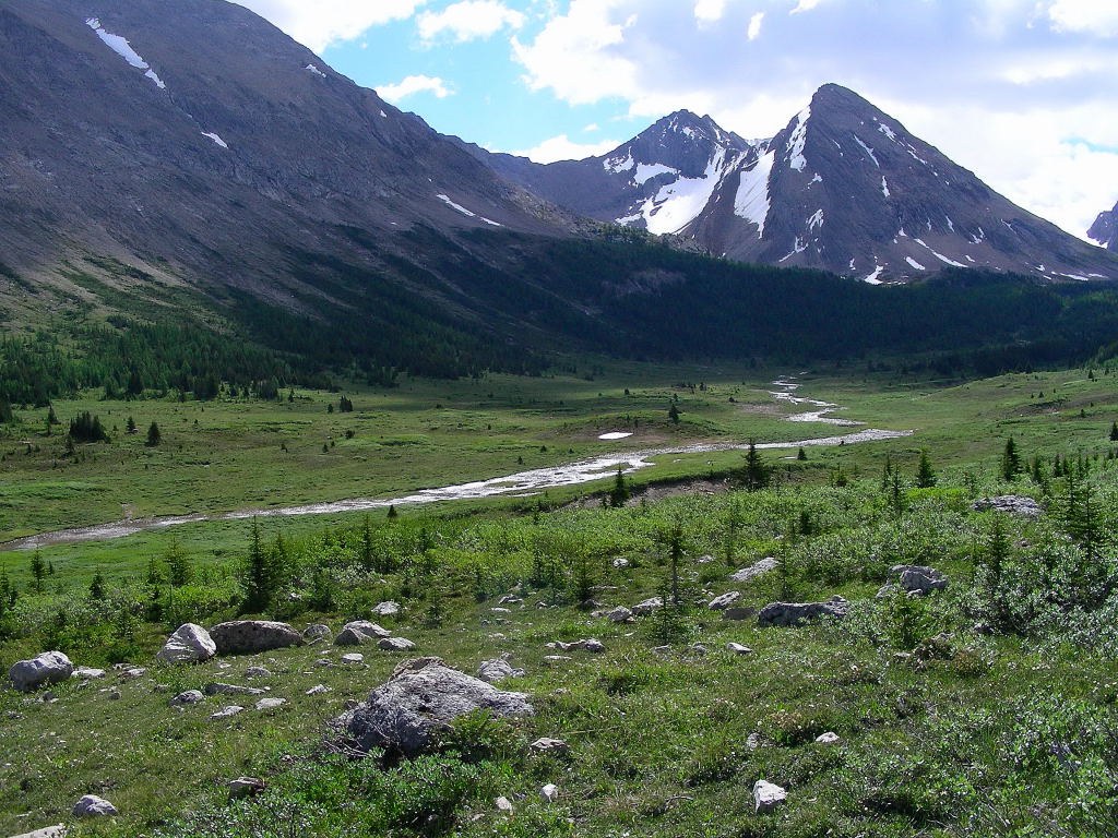
At this point the river is not much more than a small creek. I noticed that there were small trout, probably introduced eastern brook trout in the crystal clear waters. Nestled in the valley surrounded by the summits of Cyclone, Pipestone and Skoki Mountains, and Oyster Peak, there are three Red Deer Lakes, two of which appear to drain into the Red Deer River. The other (most easily accessible) lake drains into Pipestone Creek.


One thing that I noticed immediately about the upper valley was the swarms of mosquitoes that plague the area.. I must have used half a bottle of deet that first day. This may have been the worst epidemic of mosquitoes that I have ever encountered in my Rocky Mountain travels. Usually the lack of insects is one of the things I like most about the high mountains, but this spot and the entire upper valley seem to team with the cursed parasites.

Despite the mosquitoes, the Red Deer Lakes is a very pleasant area. There were mule deer in this upper section of the valley and I found grizzly tracks and diggings. Columbian ground squirrels abound. There were also plenty of song sparrows and Oregon juncos in the region and a pair of solitary sandpipers at one of the lakes. That lake also teamed with large fish that jumped out of the water every so often, landing with mighty splashes. I wished that I had brought my fishing rod.

When I returned to camp there were some fellow hikers setting up tents and preparing dinner. I cooked up my freeze dried supper - not quite up to Skoki Lodge standards, but it was all right. Somehow I was hoping backpacking foods had improved in the years since I last tried them, but they don’t seem to have advanced much. Usually I don’t have to resort to freeze dried foods on short trips, but I had a heavy load and a longer way to travel this time.

 I retired to my sleeping pad which wasn’t that great either. How did I ever sleep on those “ins-o-lite” pads when I was younger? These air pocket sleeping pads were infinitely more comfortable than those were, but my middle aged body had a hard time adjusting to even these relatively comfortable conditions.

 
Red Deer River Trail


“The clearest way into the universe is through a forest wilderness.” - John Muir


 The next morning set a pattern for the following mornings of the hiking segment of my trip. A freeze dried breakfast and instant coffee preceded packing up everything and stuffing it all in my backpack. Then I hit the trail.

The first day was a good one. I passed the Cyclone Warden Cabin and headed eastward down the Red Deer River Trail. I crossed the river and took a side trip up a glacial creek to the Natural Bridge. The bridge of limestone frames the top of a waterfall, which has cut through the valley’s headwall instead of just flowing over it. I couldn’t resist standing on top of the bridge and looking down into the icy waters beneath my feet. I gazed back down the valley and across the Red Deer River to see part of the Drummond Glacier in the distance.

Later that day, I passed the mouth of Drummond Creek, where the milky glacier melt waters mixed with the clear waters of the upper Red Deer River, doubling the flow of the river. The glacier, mountain and creek get their names from Thomas Drummond(the first botanist to visit the Canadian Rockies). Many species of plants bear the suffix “drummondii” to their scientific name, in honor of this Scotsman.

The valley below the glacier and between Mounts Cyclone and Drummond is a spectacular sight and I would have liked to explore its upper reaches. The remains of pit houses(which are believed to have been built by prehistoric hunters) have been found near the foot of the Drummond Glacier. I’m sure there is probably still much game to be found in the area. Melt water cascaded down spectacular cliffs to the valley bottom to form Drummond Creek. I waded across its icy waters, picked up the trail on the eastern edge of the valley and continued on.

That night’s camp was across the river from Douglas Lake, near a quiet backwater. I contemplated visiting Douglas Lake, but the river was high at this point and crossing it alone didn’t seem like a smart idea.

The following day was much like the day before, but I made more progress (as it was without side trips). The Red Deer River trail is a surprisingly good one considering its remoteness. The only place that I had to do any real thrashing was near Skeleton Lake, where a good deal of deadfall blocked the trail and forced me to detour through the trees. Luckily no one was around to hear my cursing. At some point I lost my bear spray when it fell out of its holster. The thought of encountering a grizzly was never too far from my mind and the loss of my “security blanket” was a little unsettling.

Later in the day I passed park warden Ivan Phillips who was traveling in the opposite direction. He had a chainsaw and said he would clear that section of the trail on his way back to the Cyclone Cabin. He is the only other person that I saw during my entire trip down the Red Deer River Trail.

I passed two sections where the force of the river has cut narrow gorges through sections of limestone. At this point the river has gathered force and volume due to the contribution of its various tributaries, entering from side valleys. It was no longer the trickling creek that I first encountered near the Red Deer Lakes. Now its mighty rumble could be heard throughout the valley. I spent some time exploring the gorge and found some beautiful yellow mountain columbine growing in the mist of its cataracts.

The nature of the forest had changed by this section of the trail. I had lost some altitude and descended from a thick subalpine forest to a sparser montane environment. The feather mosses of the upper valley are replaced by kinnick-kinnick and there are more Douglas fir and some lodgepole pine in this lower section. I saw one area where a huge herd of ungulates had passed through (probably elk). The damp ground was churned into mush by the feet of hundreds of animals passing through this part of the valley, probably on their way to higher ground.

I crossed McConnell Creek just before I made camp that evening. It was beginning to cloud over before I went to bed and the next morning I awoke to the sound of rain on my tent. I lied in bed for an hour or so, hoping that it would let up and sure enough it did. When I got out of my tent I could see snow on the mountain slopes surrounding the valley. I later received an e-mail, from the warden, saying that it had snowed at the Cyclone Warden Cabin in the upper valley. I was glad that I had only received rain - wet snow would have made the going much more difficult.

Soon I was on my way again and even after my late start, I was determined to be out of the park and into YaHaTinda by the end of the day. I crossed Divide Creek after an hour or so and looked up this side valley toward its summit. The side valley allows hikers to cross over into the Clearwater River valley and is hemmed in by Mount Tyrrell on its eastern slope. Shortly after that, I hiked out of the narrow path in the forest and onto the wider Cascade River Fire Road. This road is closed to motor vehicles and continues to the south for about 60 kilometres and emerges on the road between the Banff townsite and Lake Minnewanka. It allows those on foot or horseback to access the remote Banff Park Front Ranges and a network of rugged hiking trails. I was at a turn in the road where it headed east, following the Red Deer River valley to YaHaTinda. I embarked on the road and over Tyrrell Creek, through a burned out forest toward a growing gap in the mountains ahead of me. Soon I was out of Banff National Park. I found a bleak, windy spot where I made a makeshift camp and retired for the evening, hoping my tent wouldn’t blow away in the night.

Following the upper Red Deer River through the front ranges of the Rocky Mountains while carrying a heavy pack and video camera had certainly been an arduous task. Traveling solo through the wildest area that I have ever visited was at once a beautiful but haunting experience. My only regret was that there was little time for side trips and to explore the surrounding valleys, lakes and ridges.
 
next time YaHaTinda